
Dodge City ZIP Coverage
Dodge City has one confirmed active primary city result in the official postal material. The other codes below matter because Ford County addresses, old place names, and nearby delivery areas can appear during a broad search. They are context, not a claim that five ZIP codes lie within Dodge City. Verify a street-level result through the USPS ZIP Code Lookup before treating its city line as current.
| ZIP | Area served | Postal facility or place | Directory meaning |
|---|---|---|---|
| 67801 | Primary Dodge City mailing area | Dodge City Post Office | Usable in the assessor property-address filter, but not a full resident roll |
| 67843 | Fort Dodge historical and rural context | Retained place name after office closure | Verify the exact last line and current delivery status |
| 67882 | Wright and nearby Ford County delivery | Wright Post Office | Nearby context, not Dodge City proper |
| 67842 | Ford, Kansas | Ford Post Office | Neighboring city and ZIP combination |
| 67876 | Spearville area | Spearville postal context | Ford County context, not an extra Dodge City ZIP |
The Dodge City Post Office is at 700 Central Avenue and lists weekday and Saturday counter hours. A postal station record identifies a facility, while a ZIP code directory sorts delivery geography. Neither one identifies every person who lives inside the city.
Read the table from the question outward. A current Dodge City mailing search belongs in 67801 first. A document that says Fort Dodge calls for the 67843 history check. Wright, Ford, and Spearville matter when a countywide result or family paper supplies a nearby place instead of a city address. This keeps the ZIP code directory honest about what “serving Dodge City” can mean.
Inside Dodge City ZIP 67801
Use 67801 as the first postal filter for a Dodge City property search. The Ford County Public Parcel Search includes a Zip field beneath Property Address. Its results concern the physical address recorded on parcel cards. An owner’s mailing address may use another ZIP, and a parcel may be owned by a business or public body rather than an occupant.
The portal requires acceptance of its disclaimer, has no visible login or fee, and states that data are updated each Tuesday. Results can show an owner, situs address, mailing line, parcel ID, legal description, building facts, permits, values, and tax links. “Situs” means the place where the property stands. That is the most useful field when the aim is to sort Dodge City parcels by postal code.
| Search control | Type | How it helps |
|---|---|---|
| Property Address: Zip | Text | Filters parcel property-address values such as 67801 |
| Street Number and Name | Text | Narrows a ZIP result to a specific road or building |
| Owner Name | Text | Checks a known owner after the postal area is set |
| Parcel ID | Text, partial allowed | Uses the durable county parcel key |
| Neighborhood Code | Dropdown | Groups appraisal areas, not postal neighborhoods |
Fort Dodge ZIP History
Fort Dodge creates the most important geographic exception in this ZIP code directory. A 2002 USPS Postal Bulletin preserved the 67843 place-name and ZIP relationship after the Fort Dodge post office was discontinued. Postal wording in that source may pair the code with Dodge City, Ford, or Fort Dodge. That does not make 67843 a second active city post office.
When 67843 appears in a deed, family paper, or old directory entry, retain the wording and date from the source. Then run the full street address through USPS. Compare that response with Ford County GIS and the assessor’s situs line. This small place-name history is why a Dodge City mailing label should never be used alone to decide whether land lies inside the city.
Note: No official local ZIP split year was found, so a claimed realignment needs a dated USPS bulletin before it is repeated.
Search Dodge City by ZIP
A careful search moves from postal confirmation to a bounded official record. USPS answers how mail should be addressed. The assessor answers which parcels carry that property ZIP. GIS helps place those parcels on the county map. Kansas VoterView cannot return a ZIP-wide list, so do not force it into a task its public form does not support.
- Enter the city and state, or the complete street address, in the official USPS lookup. Save the returned last line and ZIP+4.
- Accept the Ford County parcel disclaimer. Put the five-digit code in the Property Address Zip box, then narrow with a street name when needed.
- Open the Ford County GIS and Survey Department viewer and inspect the parcel’s physical position. The county has not published a complete ZIP-field schema for the map.
- Compare the parcel’s situs, its owner mailing address, and the USPS delivery line. Record differences instead of silently changing one source.
- Once a road is known, use the Dodge City street directory for the address-level record path.
A ZIP-wide assessor result is a list of matching property-address records. It is not a list of everyone receiving mail there. The difference keeps a postal search tied to what the official record can prove.
If the portal fails, the access chain continues. Call the Ford County Appraiser about the parcel card, ask GIS to confirm the mapped location, or take a parcel ID to the county office. For a deed or legal-description question, the Ford County Register of Deeds offers a courthouse counter as well as Tapestry for occasional paid searches and Laredo for subscribers. Postal questions stay with USPS. Each office answers a different part of the address.
Dodge City Postal Screens
The USPS city and state lookup is the right starting screen when only “Dodge City, Kansas” is known.
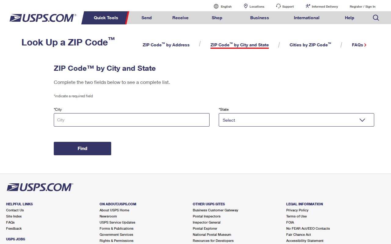
The captured form shows the official search channel used to confirm a city and ZIP pairing rather than relying on a third-party list.
The Wright Post Office listing supplies a useful check on nearby 67882.
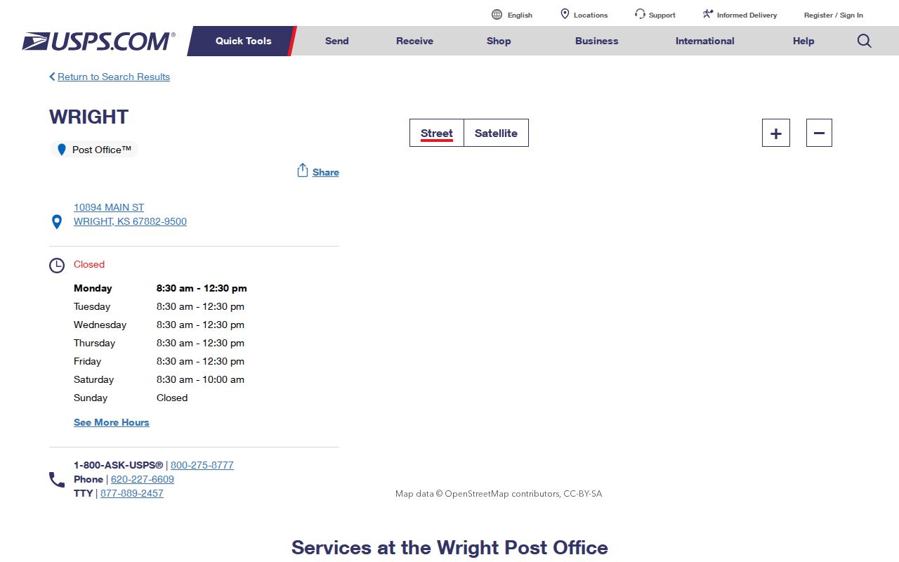
That separate facility record supports treating Wright as nearby Ford County context, not another Dodge City post office.
Dodge City Voter ZIP Limits
Kansas VoterView requires first name, last name, and date of birth. It exposes no ZIP filter. A match may confirm registration information and a polling place, but the interface is meant for an individual voter’s current check, not a neighborhood or postal-code directory.
A broader voter-data request uses the Kansas Secretary of State CVR form and requires certification and payment. County extracts are available under defined terms, protected voters remain shielded, and commercial use is restricted. For a personal ZIP search, the parcel filter is the simpler official route. Do not treat a failed VoterView search as proof that no one lives at an address.
The Ford County Election Office is the local fallback for a current registration question. Historical work belongs with the Kansas Historical Society’s Dodge City voter register, city directories, or Census sources, none of which should be treated as a current ZIP-based roll. Record the year whenever an older name is connected to a place.
Dodge City ZIPs and ZCTAs
Census ZIP Code Tabulation Areas, called ZCTAs, are statistical shapes built from Census blocks and USPS delivery geography. They approximate where a ZIP operates, but they are not USPS routes or legal city limits. The Census ZCTA guidance explains that distinction.
Dodge City and ZCTA-style areas such as 67801 and 67882 can appear in Census products. Their population totals describe an area, not a resident directory. The city itself had 27,788 people in the 2020 Census, while the cited current estimate was 27,653. Those figures give scale only. They cannot identify a household or prove that an address is within Dodge City.
Dodge City ZIP Boundary Rules
A postal city line, a municipal boundary, and a parcel’s legal description answer different questions. Rural delivery, post-office boxes, Fort Dodge, Wright, Ford, and Spearville can produce a familiar county or city name without the same legal geography. When records disagree, USPS should confirm delivery, Ford County GIS should confirm parcel location, and Dodge City Development Services can address city assignment questions.
- ZIP code
- A five-digit USPS code used to sort and deliver mail.
- ZIP+4
- The five-digit code plus four digits that narrow a delivery segment or address group.
- PO-box ZIP
- A code or delivery pattern tied to post-office boxes rather than a mapped resident boundary.
- Unique ZIP
- A ZIP assigned to a high-volume organization rather than a general neighborhood.
- Carrier route
- A postal delivery path that may cross boundaries people use for cities or neighborhoods.
Boundary check. Save the search date, USPS last line, assessor situs, mailing address, and parcel ID. If they differ, keep each custodian’s wording.
Older Dodge City sources may predate ZIP codes altogether. Search those records by street, lot and block, telephone exchange, year, or legal description. The Kansas Historical Society’s city directories, historic voter register, Census material, newspapers, and Sanborn maps provide the bridge into that earlier record era.
A questionable apartment, rural route, or multi-entrance building deserves the same restraint. Keep the unit or box number in the USPS query, use the parcel only for land geography, and ask the custodian when the record lacks a clear match. A ZIP code directory narrows the field; it does not replace address verification.