
Walk a Dodge City Street
A reliable street-by-street search follows the place before the person. Ford County's parcel card supplies the current tax-roll owner, situs address, parcel key, legal description, building facts, and permit entries. The county map then places that parcel among nearby lots. Deeds connect the legal description to earlier owners. A named voter can be checked separately, but Kansas VoterView does not produce a public list for a street.
Use the following order so a similar name or an old road label does not send the search to the wrong property:
- Enter the street number and street name in the Ford County Public Parcel Search. Try the street name alone when building a street-wide parcel set.
- Save the situs address, owner label, parcel ID, Quick Ref ID, subdivision or tract, and the date searched.
- Open the Ford County GIS and Survey Department viewer, locate the same parcel, and click along the block.
- Carry the legal description to the Register of Deeds. Search the current owner as grantee, then follow grantors backward.
- For a named person, use the official voter lookup or a dated directory. Neither source is a complete household list.
This Dodge City street directory method yields a dated parcel set, not a live roll of occupants. Record whether each result is residential, commercial, exempt, agricultural, vacant, or utility property before drawing any conclusion.
Dodge City Street Search Fields
The Ford County Aumentum portal has detailed filters for a free public search. It requires an acceptance step, no visible account or payment, and says its data are updated every Tuesday. The disclaimer also carries the Kansas restriction against compiling names and addresses to sell or offer goods or services. For most street directory work, start with only the address fields and narrow later.
| Field group | Exact controls | Use by street |
|---|---|---|
| Address | Street Number, Street Name, Zip | Find one parcel or matching street records |
| Owner | Owner Name, Primary owner | Check a tax-roll owner, not an occupant |
| Legal | Parcel ID, Quick Ref, Section/Township/Range | Bridge an address to a deed or plat |
| Value and class | Appraised range, property class, acres, neighborhood | Narrow a large mixed-use result set |
| Building | Style, year, beds, baths, basement, LBCS use | Distinguish structure type and era |
| Result card | Owner, mailing/situs, legal, permits, tax and sketch links | Save stable identifiers and access date |
A property card can expose plat references, lot dimensions, valuation, building sections, improvements, and permit numbers. Yet the breadth of the card does not make it a resident roster. A government parcel, vacant lot, apartment building, or trust-owned home may all return an owner label that says little about present occupants.
Note: Aumentum updates weekly, so save the search date whenever a parcel card supports a Dodge City address finding.
Dodge City Records by Street
Each address-keyed source answers a different question. The appraiser identifies the tax-roll owner. GIS establishes parcel geography. The recorder proves transfers and legal descriptions. City files can date work at a structure, while voter and historical directory sources can support a named-person check within their own limits.
| Address source | Record keeper | Evidence returned | Access route |
|---|---|---|---|
| Tax parcel | Ford County Appraiser | Owner, mailing and situs, legal description, buildings, permits | Free Aumentum portal, Tuesday update |
| Parcel map | Ford County GIS | Boundaries, adjacent lots, subdivision and map layers | Public viewer; paid data orders and custom maps |
| Deed index | Ford County Register of Deeds | Parties, recording data, instrument and legal description | Tapestry, Laredo, courthouse counter |
| Permit or code file | Dodge City offices | Work, dates, notices, and named parties in a file | Parcel card, office request, or KORA request |
| Voter evidence | Kansas SOS and county election office | A particular registration match and precinct data | Name and birth date; certified data request |
| Historical directory | KHS and Heritage Center | Dated household, business, telephone, or address listing | Catalog, shelf, microfilm, or interlibrary loan |
The strongest chain uses the parcel ID and legal description between systems. A street spelling may change. A lot and block usually remain the better bridge, though a split or new plat must still be checked.
Dodge City Address Terms
Three address labels often sit close together but mean different things. Misreading them is the fastest way to attach an owner to the wrong place. Ford County's inspected courthouse card showed matching owner-mailing and situs lines, but another parcel may name a trust, business, bank, estate, or owner whose mail goes elsewhere.
- Parcel
- A tax and map unit identified by the county. One parcel can hold several buildings or addresses.
- Situs address
- The location assigned to the parcel or building. It is not proof of who receives mail or lives there.
- Mailing address
- The destination for owner correspondence or tax notices. It may be outside Dodge City.
- Plat
- A recorded map that lays out lots, blocks, streets, or a subdivision.
- Criss-cross directory
- A directory arranged by street or telephone number rather than only by surname.
Apartment buildings, duplexes, converted dwellings, and commercial sites make this distinction critical. A single parcel card can represent many units without naming the people inside them.
Map Dodge City Street Parcels
Ford County GIS links parcel ownership, subdivision, survey, zoning, flood, and voting maps. Zoom to the subject street, click one parcel, note its popup identifier, then pan to the next lot. Verify each owner card in Aumentum rather than copying a label from an aerial view. Roads, alleys, rail corridors, drainage, and irregular lots can make two sites look adjacent when they are not.
The county did not publish an exact field-by-field schema for the client-rendered map. Do not expect a documented radius or buffer control. Ordinary browsing showed no login or payment, while the county separately prices parcel/address datasets, plotter prints, buffer maps, and custom work. The official parcel-map disclaimer says the product is informational, not a survey, conveyance, or navigation tool.
GIS is the visual part of a Dodge City street directory, but the deed and tax card remain the record checks. Use the map to choose parcels, not to guess at occupants.
Dodge City Streets Meet Deeds
The Ford County Register of Deeds holds deeds, mortgages, liens, foreclosures, cancellations, and other property instruments back into the 1800s. Staff can explain the index and recording process, but the office states that recorders are not researchers. Bring a specific owner, legal description, document number, or date range.
Online access has two paths. Tapestry is pay-as-you-go and searches grantor or grantee, recording date, document number, subdivision, or metes-and-bounds description. The county sheet lists $8.75 for an index and image search, plus $1 per printed page. Laredo requires an agreement and subscription. County material states deeds are indexed online back to 1963, images begin in July 2001, and older indexing continues in stages. Earlier books remain a counter or archive task.
The successful assigned capture comes from the official Ford County recorder page.
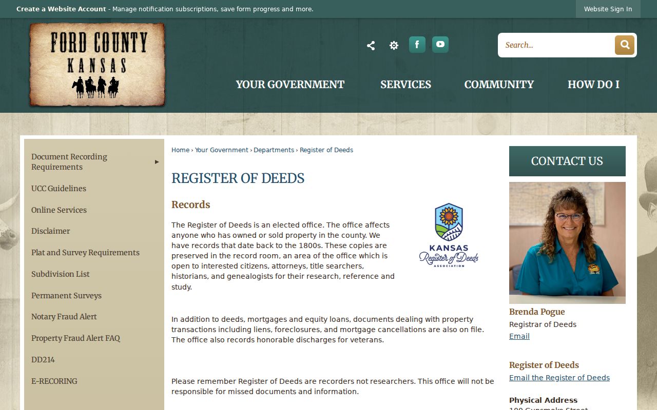
The screen grounds the deed step in the county office that keeps the legal chain, while parcel and household evidence must still be checked elsewhere.
Dodge City Street Permit Clues
Aumentum parcel cards may list permit number, work type, amount, and date. That can date an addition, roof, mechanical replacement, remodel, or change of use. It rarely proves who occupied the site. When the parcel card is not enough, contact Dodge City Development Services or Code Enforcement for a specific existing file.
No public city portal with address-search fields was found for permits or code cases. The fallback is an office request with the exact address and date range, followed when needed by a written request under the Kansas Open Records Act. Complaint details, safety facts, and active investigation material may be withheld. City archive categories can also reveal an applicant, owner, or contractor in a planning or commission packet even though the archive has no resident search box.
Note: A permit dates work at a Dodge City property; it does not establish who lived at that address.
Dodge City Street Voter Limits
Kansas VoterView asks for first name, last name, and date of birth. It is not a street browser. A full voter-data extract uses the Kansas CVR request process and is subject to certification, restricted uses, and protected-address rules. The Ford County Election Office is the local access point for current election questions.
A registration match can support a known person's current record. It cannot enumerate every adult or child at an address, and no match does not prove a house is empty. Protected voters and Kansas Safe at Home participants require stronger care. Never scrape the lookup or publish a block-level list of private people.
Dodge City Street Names Shift
The city engineering map book was compiled in 2000 and revised in 2018. Its index includes numbered avenues, Avenue A through P, Central, Front, Trail, and Wyatt Earp. It is a present-day navigation source, not proof that an old address used the same label. Ford County Historical Society traces a verified name chain from Tin Pan Alley to Chestnut and then Wyatt Earp Boulevard.
No official source established a citywide renumbering year. Use the evidence that does exist. The Wright Park plat was filed in 1876. A later ordinance renamed undeveloped Casa Del Rio streets but said no addresses or postal deliveries existed there, so those changes do not prove a household moved. When an old street fails, search the legal description, plat, ordinance, historical map, and directory year.
The 1926 Dodge City Sanborn map can help match the street and building footprint. Historical collections belong on the Dodge City city directory page, where their irregular years and formats are treated in full.
Dodge City Street Directory Limits
No official source provides a complete current list of everyone living along a Dodge City street. Parcel cards name owners, not all occupants. Voter records omit those who are not registered and protect some addresses. Utility, delivery, school, and motor-vehicle address data are not ordinary public resident sources. A directory can also be stale, and a commercial compilation may merge people from nearby homes.
A useful street directory result is modest and dated: the query, source, parcel ID, owner label, situs, mailing address, legal description, property class, and access date. Mark every inference. Check the custodian again when a decision depends on a current fact. For family history or neighborhood curiosity, move from the place to a specific record and stop when the official trail ends.
Lawful use. Use Dodge City address records only for lawful personal research. Kansas law does not permit stalking, harassment, intimidation, or misuse of protected addresses.